"Graphical Altimeter" is Smart, Interactive and Beautiful. Bikers, skiers, runners, cyclists, mountaineers, hikers, air balloons lovers, parachute ... Read More > or Download Now >
Air Graphical Altimeter for Windows Phone
Tech Specs
- • Version: 1.0.0.0
- • Price: 0
- • Content Rating: Not Rated
- • Requirements: Windows Phone 8.1, Windows Phone 8
- • File Name: Air-Graphical-Altimeter.XAP
User Ratings

- • Rating Average:
- 5 out of 5
- • Rating Users:
- 1
Download Count
- • Total Downloads:
- 2
- • Current Version Downloads:
- 2
- • Updated: August 5, 2016
More About Air Graphical Altimeter
Bikers, skiers, runners, cyclists, mountaineers,
hikers, air balloons lovers, parachute jumpers,
hobbyists, just everyone who travel, all will be thrived
using this incredible, unique and carefully designed altimeter.
It's easy.
It’s useful.
It's pleasure to use.
And results are beautiful.
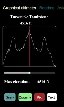
Just look at the pictures of some of my trips.
"Graphical Altimeter" creates following graphs of your trip:
a) “Sea level +” ( graph as view from above )
b) “Sea level –“ ( detailed graph )
c) “Zoom in” ( very detailed view + - .0001f)
"Graphical Altimeter" collects statistics of your trip:
a) min elevation,
b) max elevation,
c) average elevation,
d) difference between max elevation and min elevation,
e) start time,
f) end time,
g) number of points on graph and more.
"Graphical Altimeter" allows to create pictures of:
a) graphical altimeter with graph,
b) just graph,
c) just statistics
"Graphical Altimeter" allows sharing graph/pictures using:
a) text messaging,
b) email
"Graphical Altimeter" allows interaction with graphs:
a) you can navigate graph
b) you can get elevation of any graph point
c) you can get time from start to any point
d) and much, more such as Zoom in, Zoom out
"Graphical Altimeter" allows you to resume graph:
you can stop for lunch or sleep, turn your phone off
and then next time it will start where it stopped.
"Graphical Altimeter" creates graph with unit of your choice:
foot, mile, meter, kilometer.
Application also includes:
a)"Digital Altimeter" with multiple shapes,colors,fonts,zooms
c)"Readme",
d) and much more.
You will love using "Graphical Altimeter".
You will love using "Digital Altimeter".
You will love sharing your travels with your friends by
texting, emailing your graphs.
I hope you're will enjoy it.
I do it any time I'm hiking or driving.